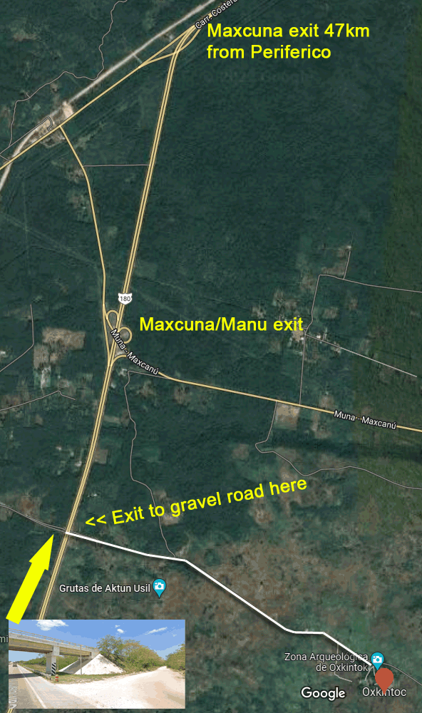
Let’s start with how to get there. Google Maps will give you a couple of options off the big main Merida-Campeche highway, but there is a much faster, easier way. Go around Merida on the Periferico and exit at the Campeche highway 180; head south.
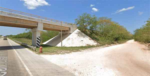
After the town of Kokomá, the next exit is to Maxcanú. Don’t take it, nor the next Maxcanú exit. Instead, just drive a bit farther until you see the big overpass. Slow down, and just before the bridge there is a gravel turnoff to the right. Take that, drive the short distance to the paved road, and turn left. Drive 2.5km (OK paved road with some potholes) to Oxkintok.
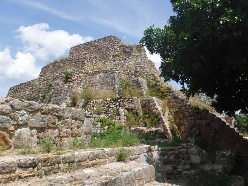
Oxkintok is much older than most of the sites we visit, with its history beginning around 600 B.C.E. in the Early Classic Period. It was occupied for nearly 2,000 years, and has architecture from the Early, Late and Terminal Classic periods. There are examples of several different architectural styles, so it’s a fascinating place to explore!
HELPFUL HINT: wear long pants, enclosed shoes/boots or at least socks over your ankles. The grounds are not manicured like some Maya sites; there are some higher grasses including some prickly stuff. Nothing serious, but you’ll be more comfortable if your ankles are protected.
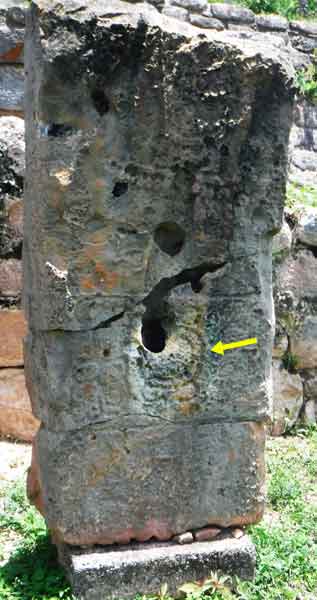
We had the unique opportunity to tour Oxkintok with two Mayanologists from the USA. Imagine looking at a stela covered with glyphs and have someone actually read them to you! (Can you see the symbol for the sun god in the photo?)
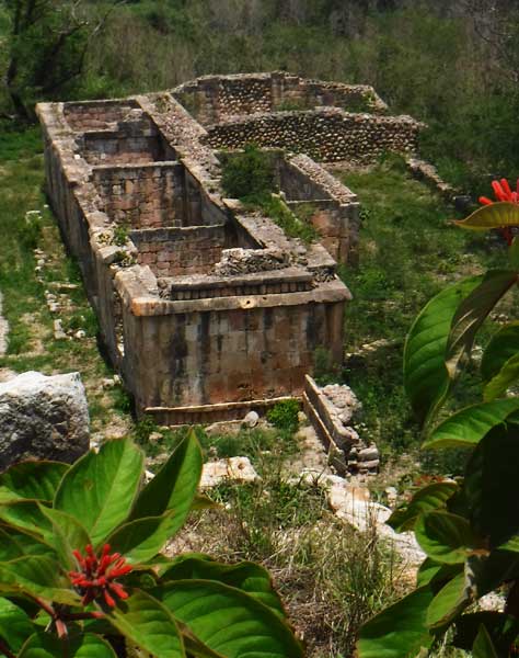
Lots of buildings to climb, including pyramids. The photo below is about the best view I’ve ever seen of a building with a floor plan that could easily have been built last year.
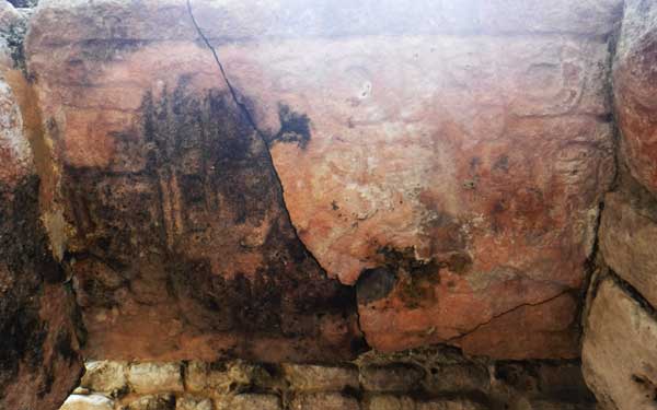
The photo to the right of that building is looking UP at the lintel over a doorway between two of its rooms. Again, look closely to see the Maya writing carved into the stone.
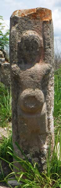
Oxkintok is well known for its many anthropomorphic statues. It is very easy to see this god is holding up the heavens.
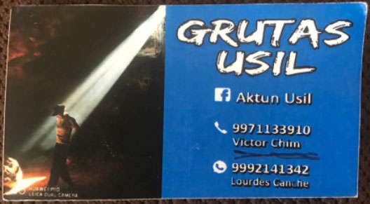
There is a LOT to see at Oxkintok! We had experts with us, but if you speak Spanish or have someone to translate, we highly recommend you hire one of the guides, Victor or Lourdes, at the entrance. A guide is required to visit the Grutas Usil (Usil Caves) which are back by the highway. The rest of this page is about that part of our visit.
The Grutas Usil
Visiting the Grutas is the reason to plan Oxkintok as a full day trip with a break between the two sites. Your guide will ride in your vehicle the 2km to the entrance next to the Merida-Campeche highway and you will take him or her back to Oxkintok afterwards. You will leave your car and walk maybe 1/2 km to the caves. Our cave tour was about 2 hours, so eat first and bring water with you!
Here’s their business card; contact them first (in Spanish) to make sure someone will be there the day of your visit. Even not understanding much of the explanations, the tour was still fascinating.
You climb down the hillside into the cave and the guide will explain how artifacts have given clues to what different areas were used for.
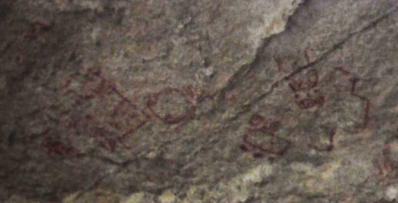
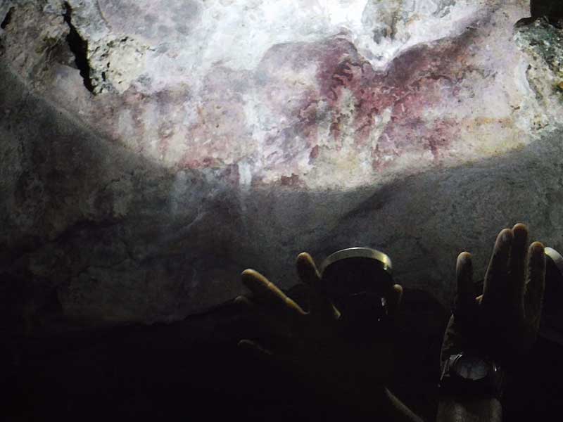
The guide will use their flashlights to point out many detailed cave paintings on the ceiling of the cave which is a good 10 meters up. We surmised that the Maya may have climbed stalactities (since broken off, either naturally or by the Maya to protect the paintings from damage) to get up there. Here’s another photo:
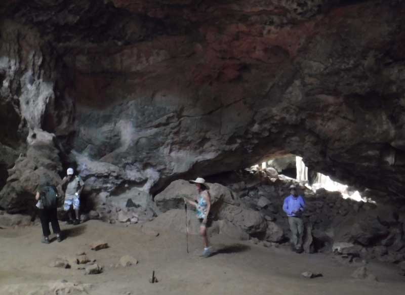
This next photo shows a wider view of the cave. As you see, you’re walking on a flat sand floor (although you will climb over some rocks into a deeper cave later).
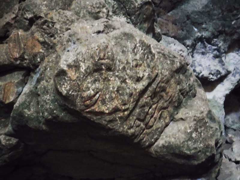
One more; a very well preserved carved rock, perhaps 1 meter in length, next to a wall of the cave.
Oxkintok and the Grutas Usil are a great day trip, less than 90 minutes from Progreso!