This story deserves the subtitle “One Trail, Three Eras”
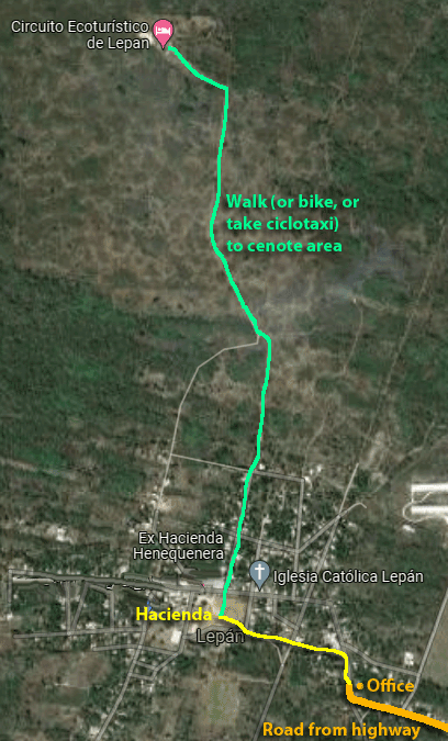
Our visit to the Circuito Ecoturistico de Lepán started with a bit of confusion. Google Maps has its location at the actual cenote site, and therefore gives directions to the closest location you can reach by road, followed by a short walk. Unfortunately, that route takes you a good 40 minutes out of your way, and you can not enter the property from that side anyway! We cleared this up through a conversation using Messenger, and instead found their little office in the village of Lepán.
Enter the village from the marked intersection off the Merida-Chetumal highway. The country road makes a right turn into the village; watch for this sign on your right.
(Our MAP page shows the location of Lepán. A detail map of the walk is at the bottom of this page.)
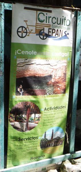
Here we met Rafael (whom we had been previously texting with and reserved our tour). He took us first on a walking tour through the unrestored hacienda buildings that form the center of town. As the first photo shows, this is one of very few haciendas that boasts two of the tall chimneys you see everywhere in Yucatán. A note at this point: none of Rafael’s team members are bilingual; you’re going to need someone in your group who can translate. CONTACT RAFAEL VIA WHATSAPP: 99 91 48 62 87 — have Google Translate handy!
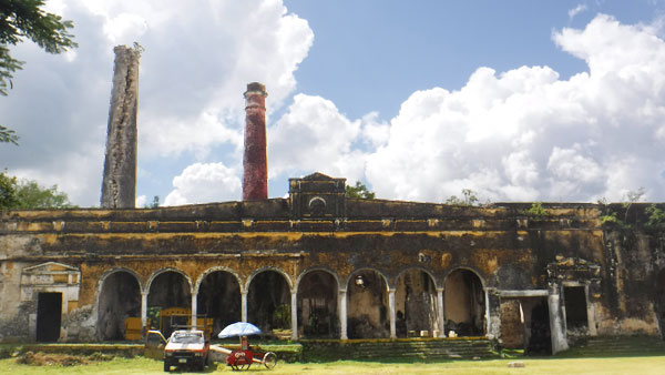
The main henequen processing building showing both chimneys 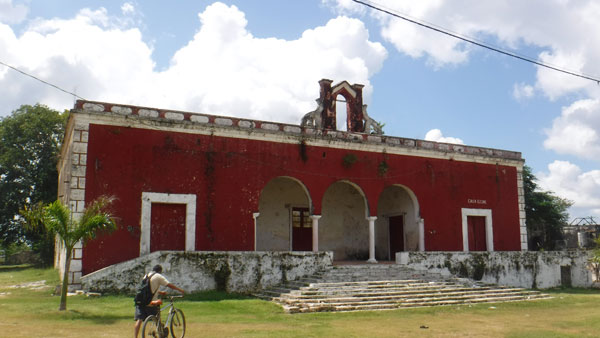
The Owner’s home and businesses offices 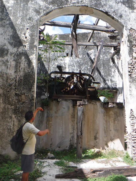
Guide Rafael shows us one of the henequen processing machines 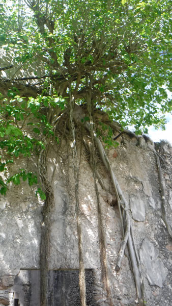
As we find everywhere, the jungle takes over everything 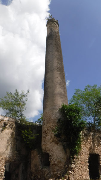
One of the two chimneys 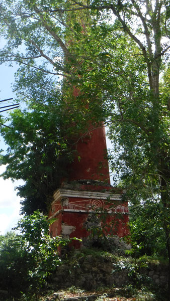
…and the second one, very close by
Next to the hacienda buildings, we pass this school building. The characters on the wall are in Korean! Koreans were brought here 100+ years ago to work in the hacienda, and there are still local folks with surnames like Kim, Park and Song. The Korean community built this school and offers various enrichment classes open to all students. (There is also a regular primary school in the village.)
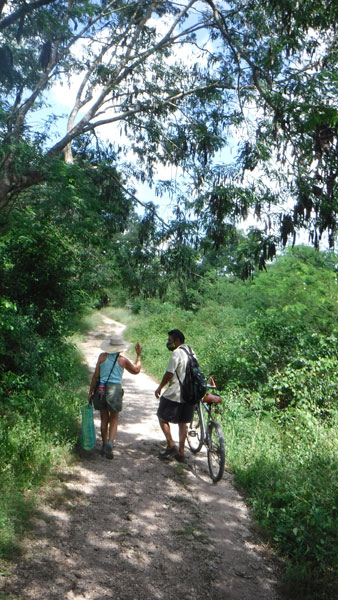
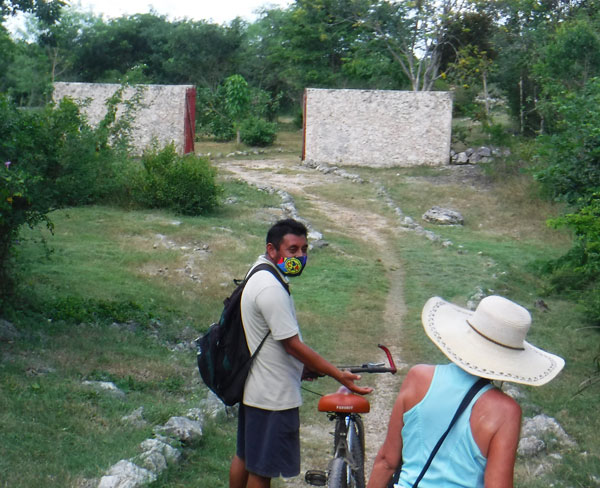
Now we’re off on our hike. The trail starts at the north edge of the village. You can do this walking or by bike, or you can have one of Rafael’s team take you in a human-powered ciclotaxi for a fee of MX$100 (up to 3 people, round trip, including waiting or coming back for you).
There is not much shade on this trail, because you will be walking through what was a completely cleared field of agave, from which the henequen will be processed into sisal fibers. Bring a hat and/or use sunscreen (but use it sparingly so you don’t pollute the cenote).
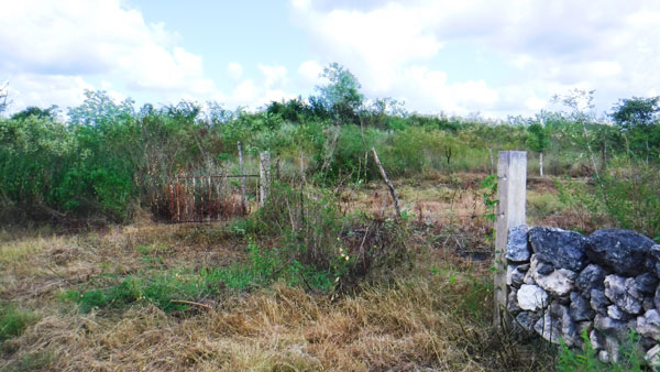
As we walked out into the open, I was struck by the fact that the road was RISING. We don’t have hills in Yucatán outside of the Pu’uc region (near Uxmal). I remarked in jest that we must be coming up onto the acropolis–high platform–of an ancient Maya city.
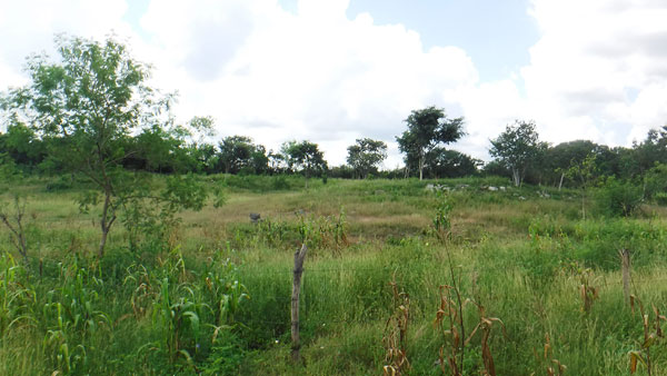
It turns out that is exactly what this was. There are very UNnatural hills and mounds around you as you walk. These photos to not show it very well (oh, for a 3-D camera!) but you can make out some of the topography. (We are only a few kilometers from the very important city of Mayapan; was this a suburb?)
This experience fills you with wonder, and is where the title of this story comes from. We’re walking through the era of the ancient Maya, and then the 19th/20th century era of the haciendas.
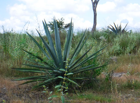
Some of the agave plants still exist today, just as reminders of that Golden Age of Henequen that brought Yucatán its wealth.
These are the first two eras this story is about.
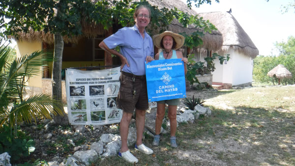
A left turn in the trail and we come upon the third era–the growing economy of ecotourism in Yucatán. State and federal government programs are helping small villages build some basic infrastructure and learn how to attract visitors to share their culture, heritage and natural assets (which is exactly what Yucatán Back Roads is about).
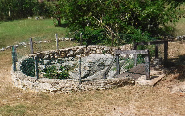
The cenote area has a few palapas along with some substantial buildings–restrooms, changing rooms, a kitchen and open-air dining area. There is also an open area for camping with a fire circle in the center.
The Lepán folks have a very pretty YouTube video that gives you a good idea of the infrastructure.
We’re holding the Camino del Mayab flag; this site is the last stop on their 120km regional tour.
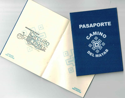
We got our Camino “Passports” stamped! The Camino del Mayab project, if you go back to Story #1, is what started this whole Yucatan Back Roads project to begin with. A great example of local people coming together and creating some real synergy.
We decided to wait on lunch (included in the MX$700-for-two package; a great meal of poc chuc, beans, Yucatecan red pickled onions, salsa and tortillas) and do the cenote first.
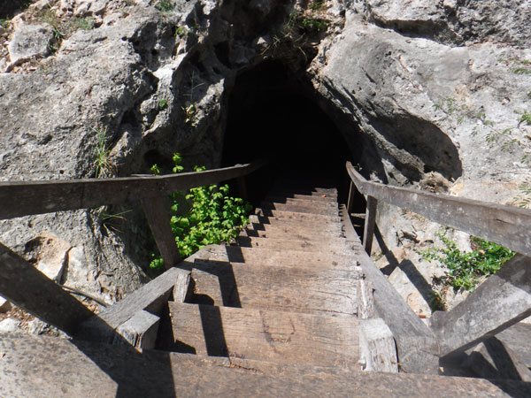
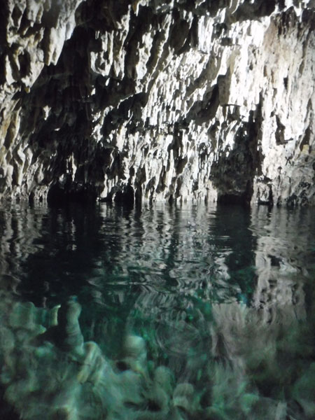
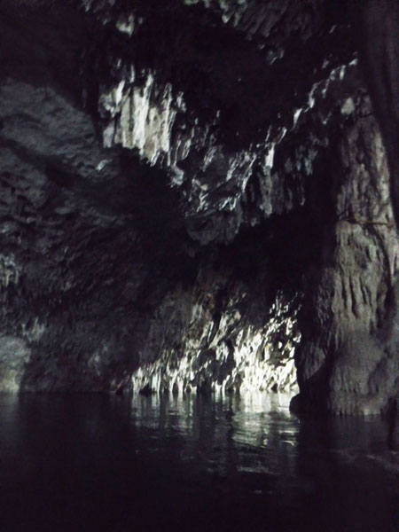
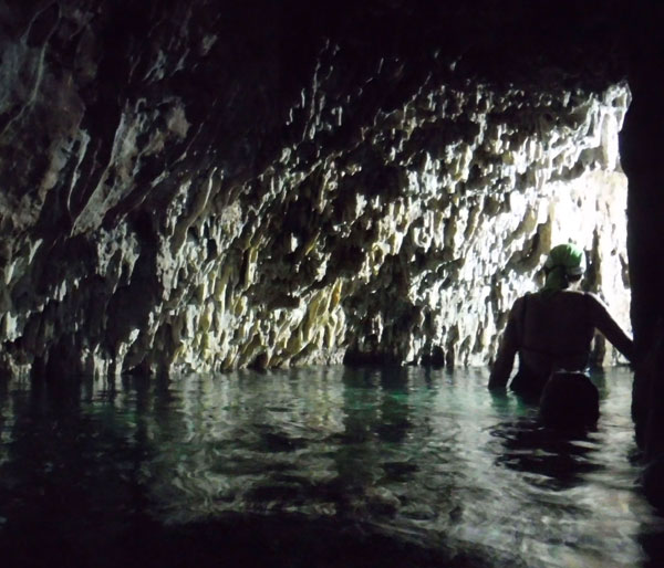
The opening is maybe 3 meters across. You enter down a steep stairway, facing the stairs and going down backwards like a ladder. Partway down the stairs become a platform; you bend down low to make it through the narrowest opening and you’re in the cave.
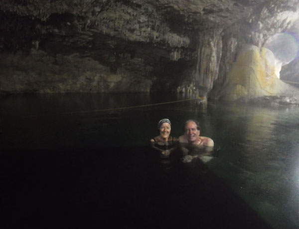
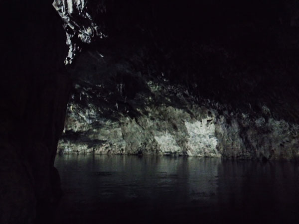
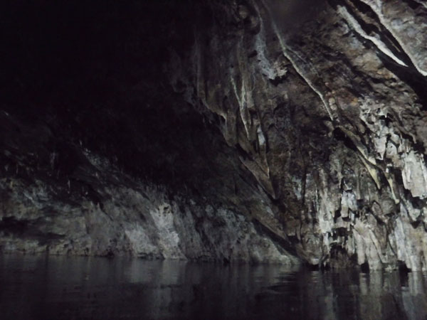
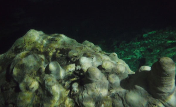
Cenote photos never do the place justice! But I hope these give an impression of the beauty of this one (especially when you have it all to yourself). The pictures DO show you the absolute clarity of the water, especially the one at the bottom taken with the camera below the surface.
After our dip in the water, we returned to the surface, had lunch and walked back to town to retrieve our car. (This was our best poc chuc EVER. Moist and tender instead of dried out, spread the beans, meat, salsa and onions on a tortilla and the combination was muy rico!) We still had some time left before needing to return home–let’s take another back road!
We jumped off the highway at Tecoh and drove into centro. The small city just had a paint job, and the main buildings look great.
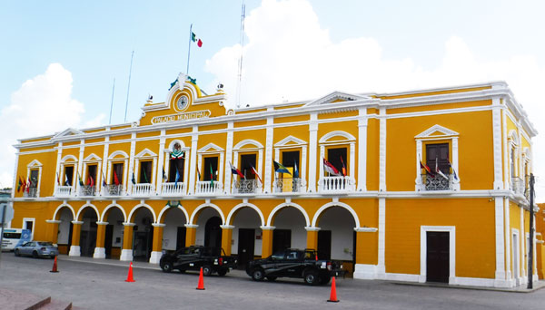
Tecoh Palacio Municipal 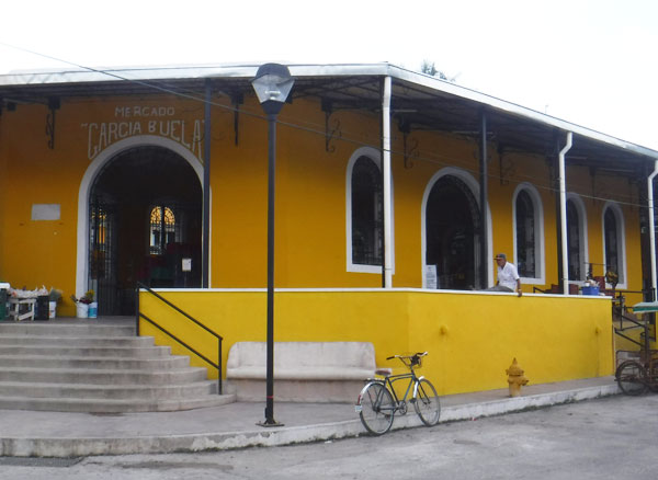
Techo Public Market 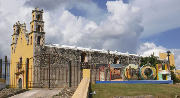
Tecoh Church and city letters
The final leg of our trip took us back to the Merida Periferico via the back roads through Sotuta de Peon. The westbound road was narrow but in excellent condition (until near the end where there were some nasty potholes).
Be sure to check the MAP page here at YBR to see our route! This is Story 5. Enjoy!